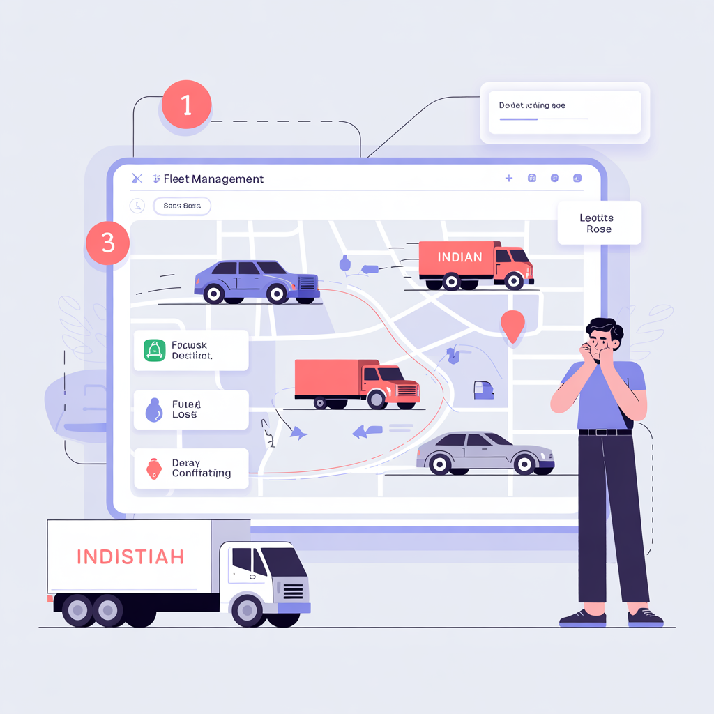
Live location on one map
4G updates every few seconds so dispatch sees speed, direction, and idle status without refreshing five tabs.
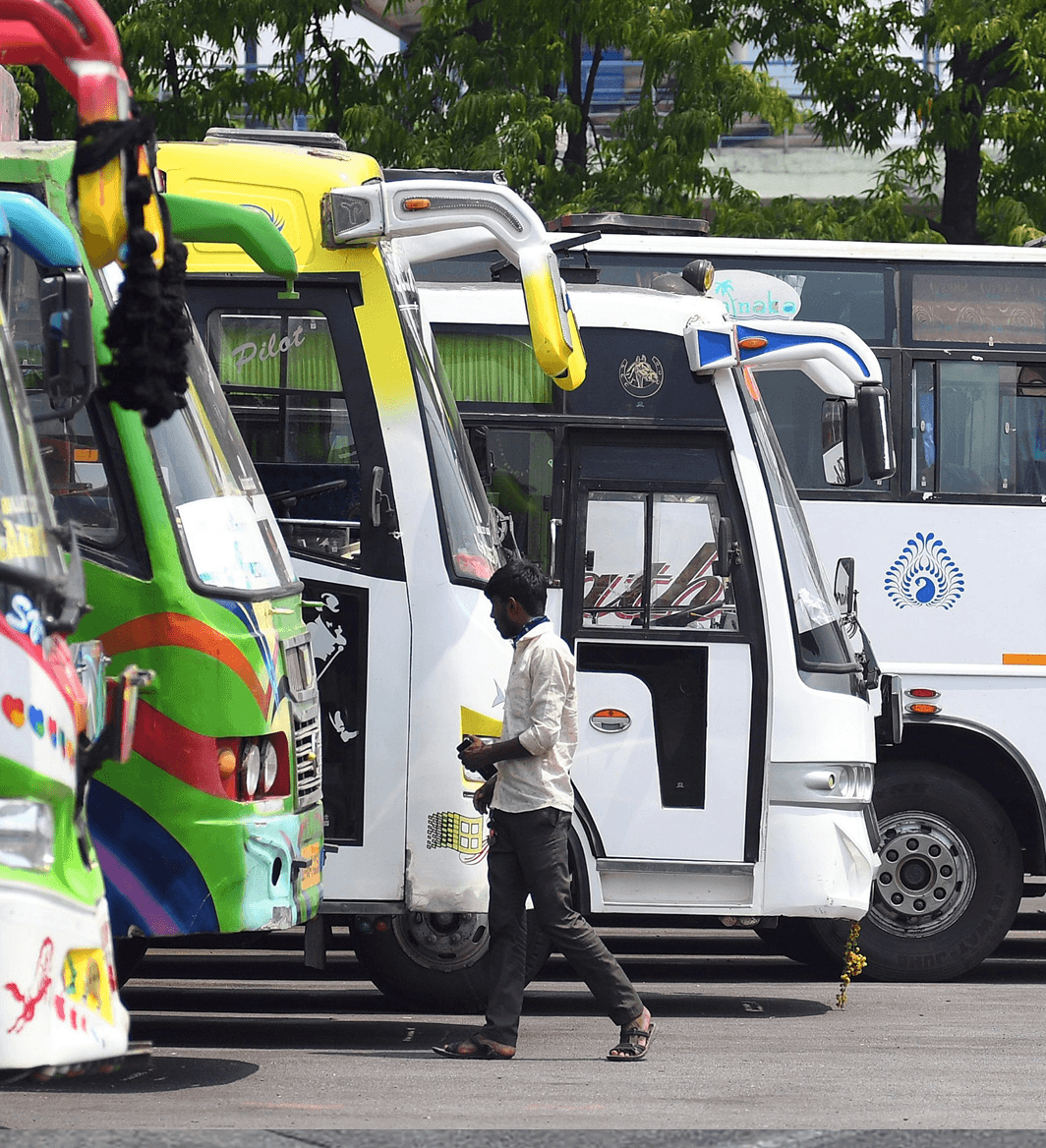
Commercial GPS fleet tracking for Indian operations
Track all vehicles on one live map, enforce route discipline with geofences, and use timestamped trip history for customer commitments, audits, and internal reviews. Built for fleets that need control, not just dots on a map.
Prefer messaging? Request a callback — our team responds promptly on business days.
Why operators choose us
Devices, networks, and people on the ground across India—so go-live isn’t where your project ends.
Our clients
Trusted by teams across India
Start with our flagship device for Vehicle Tracking Solutions—full specs and deployment guidance on the product page.
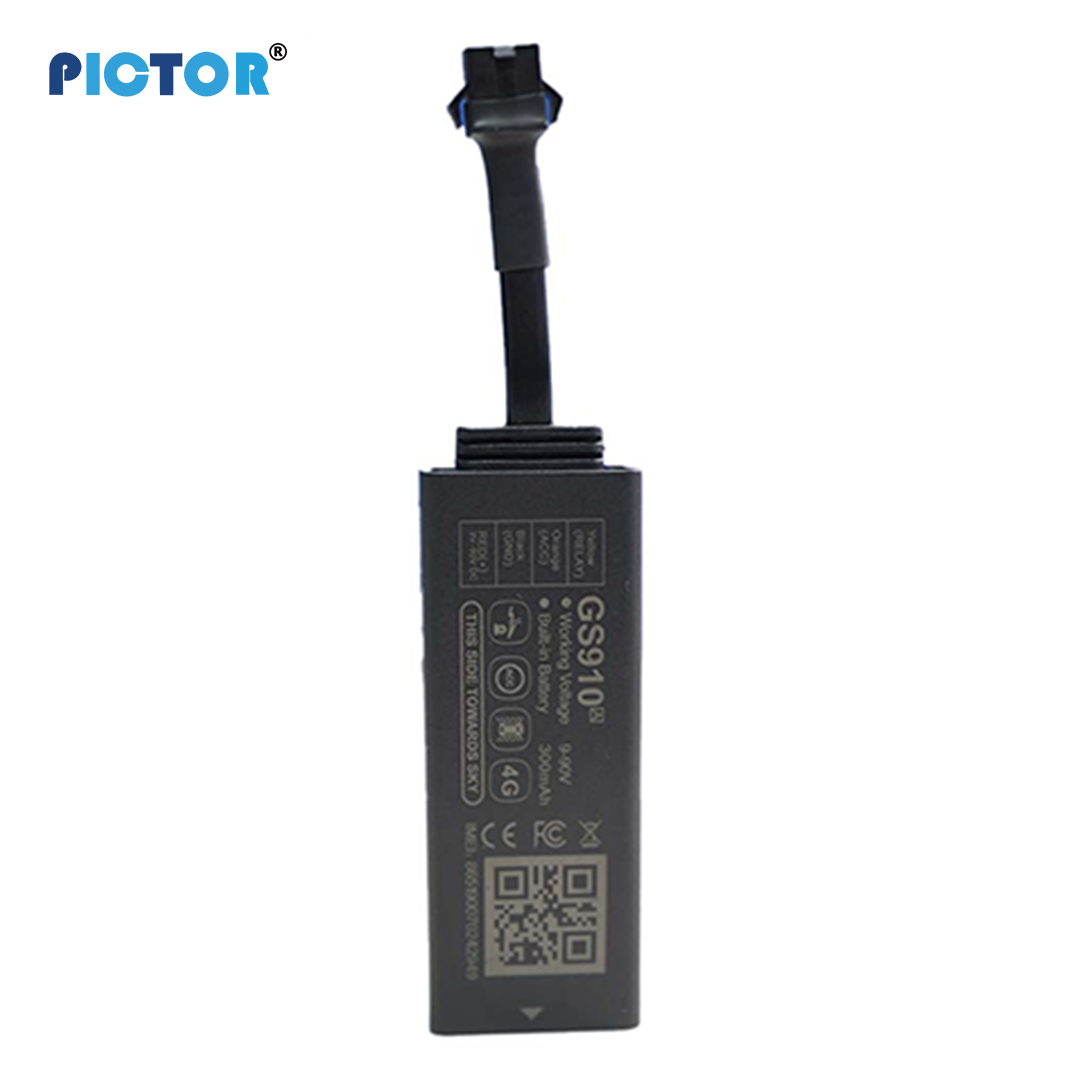
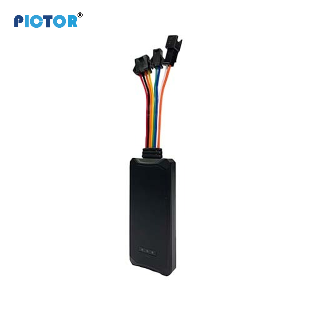
GS910 4G GPS Tracker is a compact vehicle tracking device with real-time positioning, ACC detection, remote engine cut-off, geo-fencing, and 4G LTE connectivity. Designed for automotive security and fleet management, it...
Deploy 4G GPS trackers (wired, OBD, or battery based on vehicle type) and manage live operations from one dashboard. You get real-time position, exception alerts, and route playback with timestamps so dispatch, customer support, and management work from the same evidence.
Straightforward feature notes—no jargon wall. If something here matters to your fleet, we’ll show you how it works on a call.
4G updates every few seconds so dispatch sees speed, direction, and idle status without refreshing five tabs.
Draw zones for depots, customer sites, or restricted areas. Get SMS or email the moment a vehicle enters or leaves.
Replay any day’s route: stops, deviations, and timing—useful for customer queries, RTO questions, or internal reviews.
Overspeed, harsh braking, ignition on/off, SOS, geofence breach—tune thresholds per vehicle or fleet.
Tested devices, stable 4G, and fitments for cars, trucks, buses, and two-wheelers where applicable.
Live map, alerts, and reports on browser or Android and iOS—so dispatch isn’t tied to one desk when routes or shifts change.
Typical deployments—we’ll map the closest fit to your routes, vehicles, and compliance rules.
Track vans and trucks in real time, shorten “where is my order?” calls, and use geofences to confirm arrivals at hubs or customer gates. Route playback settles timing arguments with a dated log.
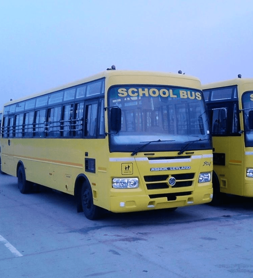
Parents and school offices see the bus on a map, get alerts when it enters or leaves the school zone, and rely on speed and harsh-event alerts to keep drivers accountable on student routes.

Monitor pool cars and executive vehicles. Log mileage for claims, flag after-hours movement, and keep vehicles inside approved areas without manual check-ins.
Run scheduled routes with bus-grade hardware. Track adherence, support ETAs for passengers, and give management a single view across depots.

Follow mixers, tippers, cranes, and pickups across job sites and yards. Cut idle burn, spot after-hours movement, and geofence plants and quarries so utilisation reports match what actually moved.

Give supervisors a fair view of territory vans and service engineers—visit frequency, route adherence, and end-of-day parking—without turning every trip into a spreadsheet debate.
Commercial vehicle tracking in India typically runs on 4G LTE backhaul with multi-GNSS positioning (GPS, BDS, GLONASS where supported). Devices capture latitude, longitude, speed, heading, and ignition or motion context, then transmit packets to a cloud platform on configurable intervals—often every 10–60 seconds for dispatch use cases.
Update frequency is a trade-off: tighter intervals improve live map accuracy and geofence precision, while longer intervals reduce data usage on large fleets. Urban corridors with good tower density generally deliver smoother tracks; remote stretches may show brief gaps that should be reviewed against power, antenna, and SIM health—not assumed as device failure.
For operations teams, the practical outcome is a single TMS-ready event stream: live map, route playback, geofence entry/exit, overspeed, idle, and SOS alerts that dispatch, security, and customer service can reference without calling the driver for every update.
Choose fitment based on power access, tamper risk, and how quickly the unit must be moved between vehicles.
Wired vs OBD vs battery GPS trackers
| Tracker type | Best for | Install | Tamper risk |
|---|---|---|---|
| Wired (e.g. GS910) | Trucks, buses, company cars with stable power | 1–2 hours; 9–90V typical | Lower—hidden install + immobilizer options |
| OBD plug-in | Rental pools, quick pilots, mixed car fleets | Minutes; OBD-II port | Higher—easy unplug unless secured |
| Battery-powered | Trailers, assets, temporary assignments | Under 1 hour; no vehicle wiring | Medium—depends on mount and enclosure |
ROI should be modeled with explicit assumptions—not a single marketing percentage. Most Indian commercial fleets review four levers together: fuel and idle waste, unauthorized movement, route and SLA penalties, and dispute resolution time.
AIS-140 and state transport rules apply to specific vehicle classes and permit types—not every fleet car or internal pool vehicle. Hardware may be AIS-140-capable, but operators should validate applicability with compliance advisors and official MoRTH / state transport guidance before procurement.
Pictor supports commercial telematics workflows—geofencing, immobilizer integration, audit exports—but does not replace your compliance sign-off. Treat regulatory fit as a deployment checklist item alongside install quality and data retention policy.
Operational teams can see route progress, filter alerts, and verify what happened on any trip without switching tools.
Fleets use this to reduce unnecessary kilometres, improve ETA confidence, and answer customer or audit questions with reliable trip records.
From installation to live monitoring, the workflow is simple enough for operations and technical teams to adopt quickly.
Step 1
Fit the device to the vehicle—wired, OBD, or battery as needed.
Step 2
GPS and events stream securely so nothing depends on manual updates.
Step 3
Maps, reports, and alerts in the same login—web and mobile.
A GPS unit is installed on each vehicle (wired, OBD, or battery model based on use case). The device captures location and movement signals, then transmits data over 4G to the cloud platform. Dispatch and operations teams monitor live maps, configure alert rules, and review route playback from web or mobile. Typical installation is 1-2 hours per vehicle, followed by dashboard onboarding for your team.
Browse device categories that pair with Vehicle Tracking Solutions—specs and compatibility on each page.
Wired GPS Tracker - Enterprise-grade telematics solutions for fleet and asset management across India.
View devices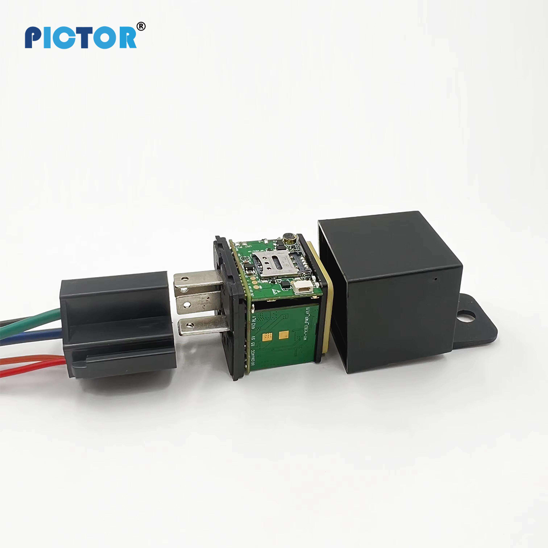
Relay GPS Tracker - Enterprise-grade telematics solutions for fleet and asset management across India.
View devices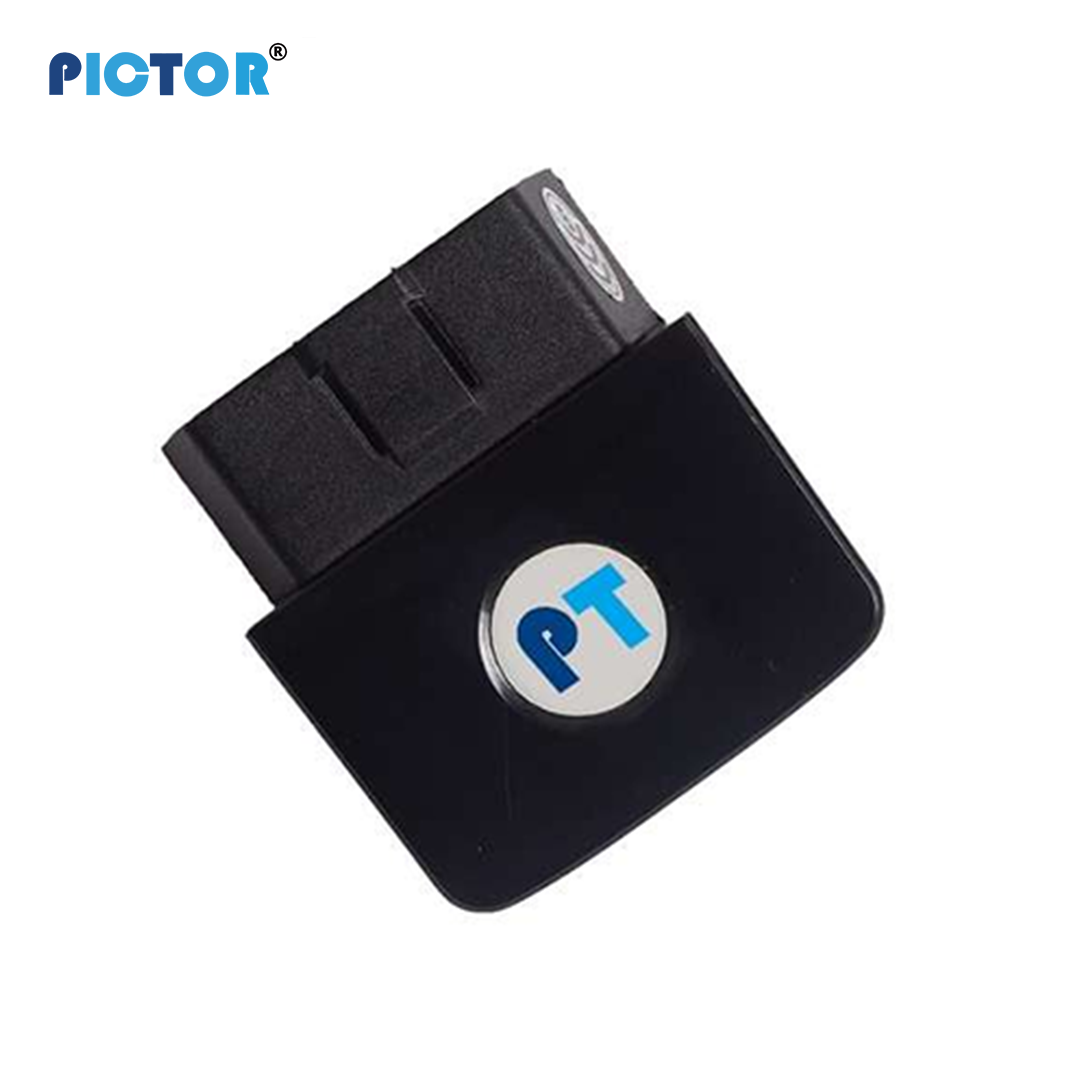
OBD GPS Tracker - Enterprise-grade telematics solutions for fleet and asset management across India.
View devicesUse these planning anchors for internal approvals and rollout readiness before procurement.
Typical flow: discovery and scope lock, pilot deployment, KPI validation window, then phased expansion. Exact timelines vary by fleet distribution and install constraints.
Incident priorities are triaged by business impact. Critical cases receive accelerated handling; final resolution windows depend on dependency class and on-ground access.
ROI estimates should separate hard savings (fuel, idle, misuse) from risk savings (incident/dispute reduction). Baseline and review periods must be agreed before rollout.
Integration plans are scoped by data exchange method, event triggers, and reporting ownership. API/webhook requirements are validated during technical discovery.
Written by
Pictor Telematics Solutions Editorial Team · Fleet Telematics Product Guidance
Reviewed by
Mr. Rajesh Kumar · Founder Director & Chief Executive Officer
Published
Jan 15, 2024
Last reviewed
Apr 10, 2026
Validation approach
Solution pages are reviewed against hardware capabilities, rollout workflows, and KPI assumptions from commercial deployments since 2014.
Book a demo tailored to your vehicles, regions, and integrations. Our specialists respond fast—usually as quickly as possible on business days.