
How to use this page for evaluation
- Confirm whether your operating pattern matches this scenario.
- Map the workflow changes needed for dispatch, safety, and reporting teams.
- Review related solutions and compare deployment models before purchase.
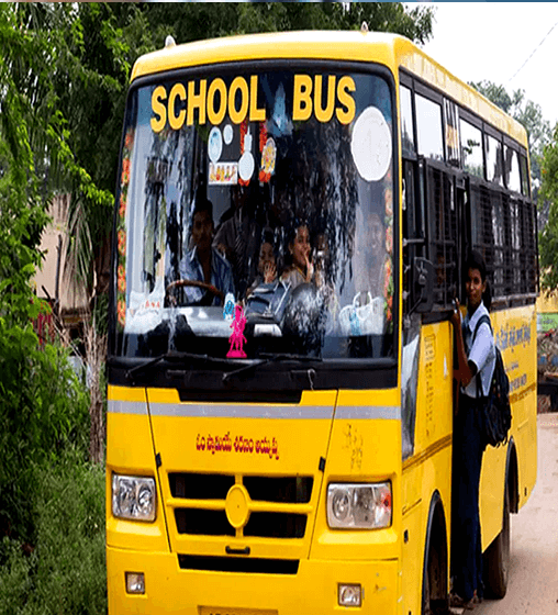
Industry Background: Student Safety Requires Real-Time Systems
Student movement today spans home pickup points, school transit routes, campus zones, and extracurricular locations. In dense urban traffic and dynamic city environments, traditional attendance and manual supervision cannot provide continuous visibility. Parents increasingly expect schools to deliver not only education but also measurable safety assurance.
Why Parent Expectations Have Changed
Families now expect real-time updates and transparent communication on child movement and safety status.
Limits of Legacy School Safety Models
Static ID cards and manual checks identify students but do not provide live tracking, alerting, or emergency communication.
The Problem: Safety Visibility Gaps at Scale
A private school with 2,000+ students wanted to modernize student protection beyond attendance and transport supervision. The school needed a practical way to monitor movement, reduce parent anxiety, and improve emergency response capability across a large student base.
No Real-Time Student Tracking
The school had no dependable live visibility once students left home or campus boundaries.
High Parent Anxiety and Frequent Follow-Ups
Parents repeatedly requested status updates that staff could not provide accurately in real time.
Commute and Pickup/Drop Risk Exposure
Travel segments and walking handover points lacked continuous monitoring and instant alerting.
No Direct Student Emergency Channel
Children had no quick device-level method to trigger immediate help in risky situations.
Operational Burden at High Student Volume
Manual safety tracking across thousands of students was not scalable or reliable.
The Solution: GPS-Enabled Smart Student ID Program
The school deployed Pictor GPS-ID 002 (4G Smart ID Card) as a wearable student safety device integrated with a centralized monitoring platform for school teams and parents.
Real-Time Location Tracking
Students were visible through live location updates and movement history, with flexible tracking modes for operational efficiency.
Geofence-Based Safety Rules
Safe zones were configured for home, school, and transit corridors. Exits from defined boundaries triggered instant alerts.
SOS Emergency Button
Students could trigger immediate emergency escalation, improving response speed for unsafe or lost scenarios.
Two-Way Calling Support
Preconfigured family and school contacts enabled direct communication when needed.
Walkie-Talkie Style Communication
School operations and transport teams could coordinate quickly over network-enabled voice workflows.
Central Monitoring Dashboard
Administrators monitored student status, alerts, and movement patterns from one control interface.
Implementation Workflow
The school rolled out the system through a phased safety activation model.
Step 1: Device Issuance
Each student received a lightweight wearable GPS ID card.
Step 2: Platform Onboarding
Parents and school staff were configured for tracking access and alert notification flows.
Step 3: Geofence and Route Configuration
Home, school, and route boundaries were mapped with exception alert rules.
Step 4: Emergency Protocol Setup
SOS escalation paths and communication trees were aligned to school response SOPs.
What Changed After Deployment
The school shifted from reactive coordination to proactive safety oversight. Parent communication improved, incident response became faster, and staff workload reduced through automated monitoring workflows.
Complete Student Visibility
Live tracking and movement history created transparent, verifiable safety status.
Higher Parent Confidence
Parents gained on-demand visibility and reduced uncertainty during travel windows.
Faster Emergency Response
SOS and geofence alerts improved intervention speed in risk situations.
Improved Boundary and Route Compliance
Safe-zone exit notifications reduced unmanaged movement exposure.
Scalable Operations for Large Schools
Automation made safety management practical even with 2,000+ students.
Measured Outcomes and Stakeholder Impact
Within months, the school observed improved parent satisfaction, fewer safety escalations, faster response cycles, and stronger safety perception in admissions and community trust. Students benefited from better support access, while administrators gained a modern safety operations layer.
Why This Model Works
This approach combines three essentials: tracking (live location), communication (two-way contact), and safety controls (SOS + geofence). Together, these create a practical child-protection system for modern schools.
Recommended Setup
Issue GPS ID card to each student, configure school-level monitoring dashboard, and onboard parents to app-based tracking and alerts. Standardize SOPs for geofence exceptions and SOS response handling.
Final Takeaway
Student safety cannot depend on delayed updates or manual follow-up. Smart GPS ID cards provide real-time visibility, instant communication, and actionable alerts needed for next-generation school safety programs.
GPS Tracking for School Bus
Explore tailored solutions for your sector. View School Bus industry solutions
Explore Related Solutions
Frequently Asked Questions
Want to Validate This Use Case on Your Fleet?
Share your vehicle count, operating geography, and KPI target so we can recommend an implementation path grounded in your operational reality.